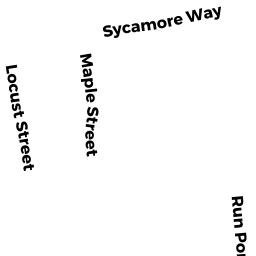
12 CHESTNUT ST
Owner Information
MURPHY PATRICK J TRS
1348 WALTER ST
YORKTOWN HEIGHTS, NY 10598


Property Details
12 CHESTNUT ST is classified as a Single Family Residential (Ranch).
The primary structure on this property was built in 1950. There are 1,594ft2 of built area within this property. There is 1,026ft2 of residential/living space within this property.
12 CHESTNUT ST is valued at $291,400. The land is valued at $124,000 and the structures are valued at $165,800. There is an additional valuation of $1,600 on this property.
The most recent deed for 12 CHESTNUT ST is recorded at the local registrar in Book 30015, Page 109. 12 CHESTNUT ST was last sold on Tuesday, October 18, 2016 for $100.
Assessment data from fiscal year 2022.
Flood Data
According to the FEMA National Flood Hazard Layer, this property does not appear to be in a flood zone. It may also be in an area not yet reviewed. Nonetheless, confirm this information prior to taking any action.
To view the flood hazards around this property, create a FEMA "Firmette" Map of the area around 12 CHESTNUT ST.
Broadband Internet Providers
| Provider | Type | Bandwidth (mbps) | |
|---|---|---|---|
| Viasat Inc | Satellite | 35 | 3 |
| Verizon New England Inc. | DSL | 5 | 0 |
| Comcast | Cable | 1000 | 35 |
| GCI Communication Corp. | Satellite | 0 | 0 |
| HughesNet | Satellite | 25 | 3 |
| VSAT Systems, LLC. | Satellite | 2 | 1 |
Broadband service provider data from December 2020.